Where's North again?
Lately, I've been collecting race circuit locations using Google Earth. It's really nice to see the sometimes very detailed satelite images of race circuits. You can actually see the seperate kerbstone blocks of silverstone, and see how many cars there were parked at the time the picture was taken. You should try it.
What really started to catch my interest is the fact that the maps of circuits as they are used in logo's or (worse) "how to get there"-maps are almost never of the "north pointing up" type. An example: The circuit "Road America", which is located a few miles north-east of Atlanta, Georgia, has a web-site which shows you a detailed map of the circuit, as well as pointers to the nearest highways. I have grabbed an image (because they only have these stupid noise making flash movie thingied nobody is interersted in after the second visit). It looks like this:

So, in my quest to find this circuit using Google Earth, I found the circuit to be along the 53, halfway from the I85 to the I985, just like the directions stated. But, the circuit seemed to be "turned around:
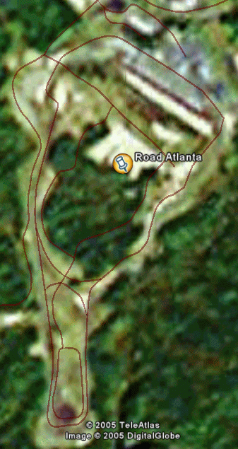
I have noticed this with a lot of ciruits. I understand the need of turning and simplifying the circuit to make a nice logo, but when the circuit is depicted next to driving directions, I would make the map "north side up" so nobody gets confused. In the first image, the I85 apears to be west of the circuit, while it is actually east of the circuit.
Google Earth location of Road America (so you can check for yourselves):